Welcome to our website and cycling club. Club membership is open to all! Whether you're a racer, recreation rider, or just starting out, the Sierra Foothills Cycling Club wants you! Get to know more about our club in our FAQ, or drop us a line from our contacts list.
Our Mission
Our club's mission is to share our passion for bicycle riding through organized events, including a variety of weekly rides designed for both novice and experienced bicyclists of all ages.
Our Rides
Our group bike rides traverse the beautiful foothills of the Sierras in and around the city of Auburn. For more information about our rides visit: ride info. Join us to explore the area while having fun, getting fit, and meeting fellow cyclists.
Ride Description and Notes: Come join the group for a climb up Baxter Road. We will leave from Penryn Park n' Ride head up through Newcastle to a left on Wise. First rest stop is the fire station. We continue on Wise to a right on Baxter and right on Mount Vernon, a right on Bald Hill. Second rest stop is at the top of Bald Hill for a view of the Sacramento valley. The ride home is mostly down hill. Coffey at Ronnie's. Hope to see you there
Route Cue Sheet --------------------------------------------- 26.9 Just Baxter -- 26.9 miles 0.1 Right -- Penryn Road 0.3 Left -- Boulder Creek Road 0.4 Right -- Boulder Creek Road 1.3 Right -- Aspen Drive 1.8 Left -- Rock Springs Road 2.1 Right -- Gilardi Road 2.7 Right -- Gilardi Road 3.9 Left -- Newcastle Road 5.4 Right -- Old State Highway 5.5 Cont -- Old State Highway 5.6 Keep Right -- Old State Highway 5.7 Right -- Taylor Road 5.8 Keep Right -- Taylor Road 5.9 Left -- Taylor Road 5.9 Make a U-turn -- Taylor Road 6 Left -- Ophir Road 7.9 Left 7.9 Left -- Wise Road 9.8 Keep Right -- Wise Road 13.1 Right -- Baxter Grade Road 15.2 Right -- Mount Vernon Road 15.9 Keep Right 15.9 Right -- Mount Vernon Road 16.5 Keep Right 16.5 Right -- Mount Vernon Road 17.6 Right -- Bald Hill Road 19.1 Cont -- Crater Hill Road 19.8 Left -- Wise Road 20.2 Right -- Lozanos Road 20.8 Left -- Geraldson Road 21.9 Right -- Ophir Road 22.7 Right -- Taylor Road 26.2 Left -- Penryn Road 26.8 Right -- Boyington Road Leader Cell:
🚴♀️ Come ride the backroads of El Dorado County! This rolling Deer Valley–Starbuck–Malcolm Dixon–Cameron Park loop has a little bit of everything—beautiful oak-covered hills, quiet country roads, ranches, fun rollers, and enough climbing to make you feel like you earned that coffee! We’ll wind through some of the area’s old Gold Rush country, enjoy plenty of scenic stretches, and then make a well-deserved coffee stop at Double Shot Coffee House. ☕️ Expect a fun, social ride with great scenery, a few good climbs, and lots of reasons to say, “I’m glad I came!” 🌳🚴♀️⛰️
This isn’t the usual Saturday route. If you want to try a bit more climbing but want to take it slow and easy, this is just for you! The first 6 miles are the hardest - a fairly gradual climb until we get to Starbuck Rd. We will have rollers in and out of town, and quiet neighborhood streets. We’ll ride along the old Country Club Rd, now closed to traffic, so feel free to ride in the middle of the road! Next, we’ll get on a bike path and finally stop at Double Shot Coffee. ☕️ It’s an easy 6 miles mostly downhill back to the beginning from there. For those that don’t want to stop, you are welcome to continue on your own to finish the ride.
Route Cue Sheet --------------------------------------------- Deer Valley-Starbuck-CP-EDH Loop -- 23.6 miles 0 Left 0 Right 0.1 Right -- Village Center Drive 0.5 Right -- Salmon Falls Road 0.5 Left -- Malcolm Dixon Road 1.6 Left -- Malcolm Dixon Road 1.7 Right -- Malcolm Dixon Road 2.6 Left -- Green Valley Road 3.6 Left -- Deer Valley Road 5.8 Right -- Deer Valley Road 6.4 Right -- Starbuck Road 9.1 Cont -- Cameron Park Drive 10.8 Right -- Oxford Road 11.5 Left -- Cambridge Road 12 Right -- Knollwood Drive 13.6 Right -- Westridge Drive 13.9 Left -- Covello Circle 14.1 Left -- Castana Road 14.4 Right -- Country Club Drive 15 Slight Left -- Country Club Drive (old road to the left…no cars or big hill!) Once you see the big hill, look to the left for the entrance. 15.8 Right -- Bass Lake Road (get on bike path) 16.9 Right -- Hawk View Road 17 Left -- Sienna Ridge Road 17.4 Keep Right -- Sienna Ridge Road
At the shopping center, we will stop at Double Shot Coffee. Once you see the car wash, turn at the driveway on the left. The official address is 3381 Bass Lake Rd Suite 100 off Sienna Ridge before Bass Lake. 17.5 Cont -- Serrano Parkway 20 Right -- Silva Valley Parkway 21.9 Left -- Charter Way 22 Right -- Keswick Drive 22.2 Left -- Fairchild Drive 22.2 Left -- Brackenwood Place - we will enter a small trail entrance that goes on a sidewalk and wooden bridge. It is on the left hand side of the street, across from the park. There is a tiny table/bench near the sidewalk entrance. 22.7 Left -- Francisco Drive (turn left when exiting the bridge area onto the street) 23.3 Keep Right -- Francisco Drive (Keep straight on Francisco) 23.5 Right 23.6 Left Leader Cell:
Saturday - Cavitt Olive Sat, Oct 3, 8:30am 0 comments
Ride Description and Notes: A bit shorter and easier since it's supposed to be warmer this weekend. This is a birthday ride for Eric. His birthday is Sunday 10-4.
Great bathroom at the gas station or at Roanies.
Route Cue Sheet --------------------------------------------- Cavitt Olive -- 23 miles
0.1 Right -- Penryn Road 0.8 Left -- King Road 1 Right -- Val Verde Road 5.3 Left -- Barton Road 6.6 Right -- Cavitt Stallman Road 8.9 Left -- Olive Ranch Road 9.9 Right -- Stirling Street 10.1 Left
10.1 Make a U-turn
10.1 Right -- Stirling Street 10.2 Right -- Olive Ranch Road 10.9 Left -- Barton Road 11.8 Right -- Del Oro Road 12.2 Left -- Del Oro Road 12.4 Right -- Cavitt Stallman Road 13.4 Left -- Laird Road 16.8 Right -- Laird Road 16.8 Cont -- Horseshoe Bar Road 18.1 Left -- Val Verde Road 19.1 Left -- King Road 19.4 Right -- Penryn Road 19.8 Right -- Boulder Creek Road 19.9 Right -- Boulder Creek Road 20.8 Right -- Aspen Drive 21.3 Make a U-turn -- Aspen Drive 21.7 Left -- Boulder Creek Road 22.6 Left -- Boulder Creek Road 22.7 Right -- Penryn Road 22.9 Left -- Boyington Road
Leader Cell:
Enduro - Slug Gulch Special Sat, Oct 3, 9:00am 0 comments
The Slug Gulch Special has three routes to choose from: a 36.7-mile short route, a 45.5-mile medium route, and a 59.6-mile long route.
The short route skips the Slug Gulch climb and gives riders a bailout option if they decide they’re not up for it that day. All three routes stay together for the first 19.7 miles before the medium and long routes head up Slug Gulch and the short route continues on Perry Creek Road.
Riders who complete the medium or long route will receive the infamous Slug Gulch pin at the top.
Long: https://ridewithgps.com/routes/56894976 Medium: https://ridewithgps.com/routes/54098761 Short: https://ridewithgps.com/routes/54098766 Route Cue Sheet --------------------------------------------- PlymthSlugL -- 59.6 miles 0.2 At the traffic circle, take the 1st exit -- Shenandoah Rd 1.7 Right -- Shenandoah School Rd 5.6 Right -- Shenandoah Rd 10.0 Cont -- Mt Aukum Rd 16.0 Right -- Fairplay Rd 16.2 Right 16.2 Left toward Perry Creek Rd 16.2 Left toward Perry Creek Rd 16.3 Left toward Perry Creek Rd 16.3 Right -- Perry Creek Rd 19.8 Left -- Slug Gulch Rd 25.2 Left -- Omo Ranch Rd 34.7 Right -- CA-88 W 37.5 Right -- Shake Ridge Rd 43.3 Right -- Fiddletown Rd/Fiddletown Silver Lake Rd 59.1 Left -- Shenandoah Rd 59.6 Enter the traffic circle Leader Cell:
Sunday - EZ Sunday (31 miles, 1550 climb) Sun, Oct 4, 8:30am 0 comments
A flatish route touring Granite Bay, a little Roseville, Folsom Lake, and Loomis. E-bike riders...please note that this route is on the American River Bike Trail for a couple of miles.
Being as this is an EZ Ride, average pace will be in the 12-14mph range. We won't necessarily stay in a tight group but we'll aim to stay within sight of each other.
No route sheets provided so if you prefer paper navigation please print your own.
Route Cue Sheet --------------------------------------------- EZ Sunday (31 miles, 1550 climb) -- 31.8 miles 0 Left -- Horseshoe Bar Rd 2.1 Left -- Val Verde Rd 3.8 Val Verde Rd becomes Wells Ave 4.1 Left -- Laird Rd 5.4 Right -- Cavitt Stallman Rd 9.8 Left -- Douglas Blvd 10.1 Right -- Woodgrove Way 10.5 Left -- Greyhawk Dr 10.7 Left -- Eureka Rd 11 Cont -- Wellington Way 11.4 Left -- E Roseville Pkwy 13.2 Left -- Barton Rd 13.3 Right -- Seven Cedars Pl 13.6 Left -- Shadow Brook Pl 13.7 Right to stay on Shadow Brook Pl 13.8 Cont -- Buckeye Ln 14 Right -- Purdy Ln 14.1 Thru gate toward Troy Way 14.2 Left -- Troy Way 14.5 Left -- Lou Pl 14.6 Right -- Auburn Folsom Rd 15.4 Cont -- Folsom-Auburn Rd 16 Right -- Folsom Dam Rd 16.1 Left -- Lakeside Way 16.4 Left -- Hollyann Dr 16.6 Left -- Inwood Rd 16.8 Right -- Van Winkle Ct 16.9 Left -- Fithian Way 16.9 Right -- Berry Creek Dr 17.2 Right -- Valley Pines Dr 17.8 Left -- Baldwin Dam Rd 17.9 Left -- Oak Ave Pkwy 18.5 Left -- Deerwood Way 18.6 Cont -- Deerwood Way 18.6 Right -- Mountain Oak Court 18.7 Left 18.7 Left -- American River Bike Trail 20.2 Keep Right -- American River Bike Trail 21.2 Right -- Beals Point 21.3 REST STOP regroup at bathrooms on Right 21.8 Right -- Auburn Folsom Rd 23.3 Right -- Fuller Drive 23.7 Right -- Bronson Drive 23.9 Left -- Hill Road 24.2 Right -- Mooney Drive 24.2 Left -- Hill Road 24.3 Cont -- Hill Road 24.5 Left -- Douglas Blvd 25.4 Right -- Auburn Folsom Rd 26.2 Right -- Morningside Dr 28 Right -- Twin Rocks Road 28.1 Left -- Blue Oak Lane 28.2 Left -- South Lake Circle 28.3 Cont -- South Lake Circle 28.3 Left -- North Lake Circle 28.4 Right -- Auburn Folsom Road 29.4 Cont -- Auburn Folsom Road 31.7 Left -- Horseshoe Bar Rd 31.8 Left Leader Cell:
Railhead, Confluence, Ridge, Dick Cook Sun, Oct 4, 8:30am 0 comments
Ride Description and Notes: 10-4, over and out ! Welcome to October. Perfect weather for this ride. Fun descent to confluence, and peaceful climb out. Meander over to Ridge, then some lighter stuff, with Indian Hill , near the end.Roll out at 0830, from Railhead Park. No route sheet or sweep, but several regroups. 43 miles and 4k '. Roger
Route Cue Sheet --------------------------------------------- Railhead, Confluence, Ridge, Dick Cook -- 43.5 miles 0 Left -- Pacific Avenue 0.5 Right -- Gum Lane - follow bike route 0.7 Left -- Belmont Drive 0.7 Left -- Belmont Drive 0.8 Right -- Stadium Way 1.1 Right -- Finley Street 1.3 Right -- Brook Road 1.3 Left -- Borland Avenue 1.7 At roundabout, take exit 1 -- El Dorado Street 3.9 Cont -- Old Foresthill Road 7.3 Left -- Foresthill Road 10.6 Cont -- Auburn Ravine Road 12.2 Right -- Palm Avenue 12.7 Cont -- Mt Vernon 14.6 Left -- Bald Hill Road 16.2 Cont -- Crater Hill Road 18 Cont -- Chili Hill Road 19.8 Left -- Gold Hill Road 20.6 Left -- Ridge Road 24.1 Right -- Taylor Road 27.5 Left -- Penryn Road 28.8 Right -- King Road 29.1 Left -- Ong/Winters Road 29.2 Right REST STOP 29.3 Left -- Ong/Winters Road 29.4 Right -- King Road 29.9 Right -- Val Verde Road 31.9 Left -- Dick Cook Road 33.5 Left -- Auburn Folsom Road 37.1 Left -- Newcastle Road 39.8 Right -- Indian Hill Road 42.2 Left -- Auburn Folsom Road 42.8 Right -- Sacramento Street 43.4 Right -- Pacific Avenue 43.5 Left into park - done Leader Cell:
Tuesday - Wise Up Tue, Oct 6, 8:30am 0 comments
Where: Newcastle Park and Ride Newcastle, CA (map)
Leader Name: Larry Merlo E-mail: larry_merlo@yahoo.com
Ride Description and Notes: The forecast is for hot weather Tuesday so let's knock this one out while things are cool in the morning. Descend Ridge and climb back up to Newcastle on Wise Rd. Regroups at Garden Bar and at the fire station on Wise.
Coffee at Northfork Chai Co.
Route Cue Sheet --------------------------------------------- Wise Up -- 21.9 miles 0.2 Right -- Old State Highway 0.5 Right -- Taylor Rd 0.8 Left -- Ridge Rd 4.3 Right -- Gold Hill Rd 5 Left -- Virginiatown Rd 7.1 Right -- Fowler Rd 8.1 Left -- Fruitvale Rd 8.4 Right -- Garden Bar Rd 9.5 Right -- W Wise Rd 19.2 Right -- Ophir Rd 21.1 Right -- Taylor Rd 21.4 Left -- Old State Highway, CA 193 21.7 Left -- Newcastle Road Leader Cell:
Wednesday - Cisco Grove - Donner Lake OAB Wed, Oct 7, 9:00am 0 comments
Where: 1/4 mi East of Cisco Rd on Hampshire Rocks Rd., Cisco Grove (map)
Leader Name: Keith Hallsten E-mail: keithhallsten@gmail.com
Ride Description and Notes: Over Donner Pass and around Donner Lake. Weather should be great this week! Grades are generally mild (< 4%), except the east side of Donner Pass, which is 3.4 miles of about 6.5%. Regroup at Donner Pass (both ways) and at the campground restrooms at Donner Lake. Probably a 2 water bottle ride.
Route Cue Sheet --------------------------------------------- Cisco Grove - Donner Lake OAB -- 38.7 miles 0.0 East on Hampshire Rocks Rd.
2.6 Left -- Donner Pass Rd
12.7 Regroup at Donner Pass 15.8 Right -- S Shore Dr 19.4 Left to stay on S Shore Dr
19.2 Regroup at Restrooms 19.6 Left -- Donner Pass Rd
Ride Description and Notes: Let's start the Meadow Vista Thursday ride at 8 - it's supposed to be HOT! There will be school traffic so be careful. We'll stay close to the park and do Three Loops. I'll have route sheets and I'll sweep this casually paced ride. Cold brew and pastries at the Local Cafe after the ride. I hope you can join me!
Route Cue Sheet --------------------------------------------- Three Loops -- 17.8 miles 0.4 Exit Park, Right on Meadow Vista Rd
Left -- Placer Hills Rd 0.9 Left -- Combie Rd 1.4 Left -- Volley Rd 1.9 Left to stay on Volley Rd 2.4 Cont -- Volley Cir 3 Right -- Volley Cir 3.5 Right to stay on Volley Rd 4 Right -- Combie Rd 4.6 Left -- Placer Hills Rd 6.1 Right -- Crother Rd 7.7 Cont -- Lake Arthur Rd
REGROUP 8.1 Right -- Meadow Gate Rd 9.9 Left -- Placer Hills Rd 11.7 Right -- Pinewood Way 11.9 Right -- Bancroft Rd 13.1 Left -- Christian Valley Rd 14.1 Left -- Lake Arthur Rd 15.4 Left -- Pinewood Way 16.1 Right to stay on Pinewood Way 16.1 Left -- Placer Hills Rd 17.6 Left -- Meadow Vista Rd Leader Cell:
Friday - Too Hot For October Fri, Oct 9, 8:00am 0 comments
Ride Description and Notes: NOTICE 8:00 RIDE START
It just seems that summer does not want to leave us. Since the weather is forecasted to be in the 90's, I thought it would be best to revert back to the 8:00 ride start for this Friday's ride particularly since most of the climbing will be earlier on. Route will take us up to Newcastle, north to Chili Hill/Virginia Town with a rest and regroup at McBean Park in Lincoln (mile 18). We'll then tour the SRL neighborhoods on our way to Twelve Bridges and SCB.
Friday Rides generally aren't swept but we generally tend to stay together in groups. If you prefer route sheets, please print them out before the ride. I won't have route sheets.
Bring plenty of water. Coffee afterwards at Roanie's.
Marc (916-201-1137)
Route Cue Sheet --------------------------------------------- Chili to SC_10_09_26 -- 31.9 miles 0.1 Right -- Penryn Road 0.3 Left -- Boulder Creek Road 0.4 Right -- Boulder Creek Road 1.3 Right -- Aspen Drive 1.8 Right -- Rock Springs Road 2.7 Left -- Brennans Road 3.8 Left -- Newcastle Road 5.4 Right -- Old State Highway 5.6 Cont -- Old State Highway 5.6 Keep Right -- Old State Highway 5.7 Right -- Taylor Road 6.1 Left -- Ophir Road 6.4 Left -- Lozanos Road 7.4 Keep Left -- Chili Hill Road 9.2 Keep Right -- Chili Hill Road 11.1 Left -- Gold Hill Road 11.2 Right -- Virginiatown Road 11.5 Keep Right -- Virginiatown Road 13.3 Left -- Fowler Road 13.4 Right -- Virginiatown Road 17.1 Left -- East Avenue 17.8 Right -- McBean Park Drive 17.9 Left 18 Make a U-turn 18 Left 18 Right 18.1 Right -- McBean Park Drive 18.3 Right -- bike path 18.7 Left -- Sun City Boulevard 20.1 Left -- Del Webb Boulevard 21.4 Left -- Spring Valley Parkway 23.9 Right -- Stoneridge Boulevard 24.5 Left -- Twelve Bridges Drive 25.8 Right -- Sierra College Boulevard 26.6 Left -- English Colony Way 27.6 Right -- Humphrey Road 28.4 Right -- Humphrey Road 29.9 Left -- King Road 30.3 Keep Right -- King Road 31 Left -- Boyington Road Leader Cell:
SFCC ANNUAL CLUB PICNIC AND RIDE LEADERS APPRECIATION EVENT
The bike rides and club could not exist without the Ride Leaders, they do a ton to support the club and make sure the rides happen. As a club, we would like to recognize all their efforts and show our appreciation for their dedication and hard work. What better way than to incorporate this recognition into the Fall Picnic where all the club members can give their thanks to the ride leaders.
Please arrive about 20 minutes early to park, sign in, and drop off your food dish.
Rides will start at 8:30am
You have three routes to choose from for Saturday’s picnic:
EZ Ride — 22 miles
27-mile ride — 1,200 feet of climbing
36-mile ride — 2,200 feet of climbing
You can also log into the SFCC website, go to the event on the calendar, and print a route sheet.
After ride potluck:
Appetizers: 11:30am BBQ: 12:00-1:30pm
Last names beginning A-M bring appetizer or Salad.
Last names beginning N-Z bring a side dish.
We’ll have a handful of mesh food covers available to help keep the flies off the food. The flies have been especially bad the past few years, so if you happen to have one or two at home, we’d really appreciate it if you could bring them along with your dish.
SFCC will provide burgers, veggie burgers, sodas and dessert.
Please no alcohol or glass containers allowed under the conditions of our permit.
For more details and to RSVP for the event and to let us know if you’d like a regular or veggie burger, please follow the link below:
Our club rides simply wouldn’t happen without our ride leaders. They put in a tremendous amount of time and effort to support the club, plan and lead rides, and make sure our rides happen week after week.
As a club, we want to recognize that commitment and show our appreciation for everything they do. What better way than to make our ride leader recognition part of the Fall Picnic, where everyone can come together and thank the people who help keep our club rides going!
After-Ride Potluck
Appetizers: 11:30 am
BBQ: 12:00–1:30 pm
For the potluck:
Last names beginning A–M: Please bring an appetizer or salad.
Last names beginning N–Z: Please bring a side dish.
SFCC will provide burgers, veggie burgers, sodas, and dessert.
Please note: No alcohol or glass containers are allowed under the conditions of our permit.
For more details, to RSVP for the event, and to let us know whether you would like a regular or veggie burger, please follow the link below:
We’re hoping for a great turnout this year. This event is also a chance for us to show our appreciation for our ride leaders and all the time and effort they put into keeping our club rolling!
Route Cue Sheet --------------------------------------------- SFCC Picnic Ride 27mi -- 27.1 miles 0 Left -- Winters Road 0.1 Left -- King Road 1.1 Left -- Taylor Road 1.3 Right -- Webb Street 1.3 Right 1.6 Left -- King Rd 1.8 Right -- Humphrey Rd 2.8 Left -- Citrus Colony Rd 3.5 Right -- Delmar Ave 4.8 Cont -- English Colony Way 5 Right -- Humphrey Rd 5.8 Cont -- Colwell Rd 6.8 Left -- Swetzer Rd 7.4 Right -- English Colony Way 8.2 Left -- Taylor Rd 10.3 Right -- Old State Hwy 10.7 Right -- Newcastle Rd 12.3 Right -- Brennans Rd 14.7 Left -- King Rd 14.8 Right -- Auburn Folsom Rd 15.8 Right -- Horseshoe Bar Rd 18 Left -- Val Verde Rd 19.7 Val Verde Rd turns slightly Right and becomes Wells Ave 19.9 Right -- Laird Rd 20.7 Left -- Rutherford Canyon Rd 21.6 At the traffic circle, continue straight to stay on Rutherford Canyon Rd 22 Right -- Barton Rd 23.5 Left -- Brace Rd 24.6 Right -- Sierra College Blvd 24.7 Right -- Taylor Rd 25.6 Left at Horseshoe Bar Rd 25.7 Right 25.7 Left 25.7 Right 25.8 Right 25.8 Left toward Webb St 25.8 Right toward Webb St 25.8 Left -- Webb St 25.8 Left -- Webb Street 25.9 Left -- Taylor Road 26.1 Right -- King Road 27 Right -- Winters Road 27.1 Right Leader Cell:
EZ Ride SFCC Picnic - Loomis Basin - 22mi Sat, Oct 10, 8:30am 0 comments
Join Jen for the EZ Ride! This is a more relaxed group ride, and the goal is to keep everyone together, with regular regroups as needed. This is not a beginner ride, so riders should be comfortable riding in a group.
Route Cue Sheet --------------------------------------------- SFCC Picnic EZ Ride - Loomis Basin - 22mi -- 21.6 miles 0 Left -- Winters Road 0.1 Right -- King Road 2.7 Right -- Auburn Folsom Road 3.7 Right -- Horseshoe Bar Road 3.8 Left -- Flower Farm 3.8 Right -- Flower Farm 4 Right -- Auburn Folsom Road 4.8 Right -- Auburn Folsom Road 6.7 Left -- Ardea Way 6.8 Right -- Ardea Way 6.9 Left -- Walden Woods Way 7.4 Right -- Walden Woods Way 7.5 Right -- Boulder Road 8.7 Left -- Morningside Drive 10.4 Left -- Auburn Folsom Road 10.7 Right -- Joe Rodgers Road 11.5 Right -- Long Meadow Road 11.6 Right -- Royall Oaks Drive 11.7 Left -- Greenbriar Lane 11.8 Left -- Hampstead Way 11.9 Right -- Rockhurst Way 12.2 Right -- Barton Road 12.5 Right -- Barton Road 14.8 Right -- Wells Avenue 19.1 Left -- King Road 19.2 Left -- King Road 19.3 Right -- Penryn Road 20.1 Left -- Boyington Road 21.1 Left -- King Road 21.5 Right -- Winters Road 21.5 Right Leader Cell:
A relaxed-pace, no-drop group ride averaging about 12–13 mph. Routes are generally 24–30 miles with light climbing and no steep climbs. There are brief regroups along the way. What’s different about this club ride is that we stay together as one group and don’t break up into separate groups.
Start locations and routes vary.
Sunday - Indian Valley-Sierra City +mini Downieville tour Sun, Oct 11, 9:30am 0 comments
Ride Description and Notes: Please join me for a beautiful ride along the Yuba River thru the historic towns of Downieville and Sierra City. Great ice cream available in Downieville after the mini tour (mile 37.3).
No route sheets provided so please print your own if you want paper navigation.
FYI - it is a slow drive to the start...please check your estimated driving time using Google Maps etc.
Route Cue Sheet --------------------------------------------- Indian Valley - Sierra City 49 w/mini Downieville tour -- 49.1 miles
0.1 Cont Straight (north) on 49 11.6 Right -- Nevada Street for water/restrooms 11.7 Right -- Main Street, CA 49 11.8 Right -- Commercial Street, CA 49 24.3 Left -- Butte St/Sierra Buttes Rd for public restrooms/water 24.3 U at picnic area & restrooms 24.3 Right -- CA-49 N 36.8 Right -- Pearl St for mini-Downieville Tour 37.1 Left -- E River St/Bridge 37.1 Left -- Main St 37.3 Left -- School St 37.3 Right -- Main St 49 End of route. Congrats! If open, food & drinks at Indian Valley Outpost or picnic at river Leader Cell:
Tuesday RideTue, Oct 13, 8:30am 0 comments
Where: Newcastle Park and Ride Newcastle, CA (map)
Tuesday rides are variable, depending on who leads and who shows up. Generally, the climbing is 1500-2500 feet, and the distance is 18-25 miles. Oftentimes, there are no regroups due to the short distances offered. This ride's start location is currently at the Newcastle Park & Ride.
Coffee and conversation afterward at Newcastle Produce.
Wednesday rides are the most aggressive rides of the week (26-40 miles) and are fairly hilly. Currently, this ride usually starts out of Meadow Vista Park in Meadow Vista. However, always check the calendar for a different start location.
Ride Description and Notes: Rest your legs on this social paced, gentle ride in the vicinity of Meadow Vista. Regroups at McElroy (U-Turn 1.9 mi), top of Crother Rd climb (10.3 mi), and at the Coyotes Yard Art (13.7 mi). I will sweep and route sheets will be available. Refreshments and chit chat at the Local Cafe afterward.
Route Cue Sheet --------------------------------------------- Combie / Crother Rd / Coyotes / Cole Rd -- 20.9 miles 0.1 Left -- Meadow Vista Road 1.9 Make a U-turn -- Meadow Vista Road 3.7 Left -- Placer Hills Road 4.2 Left -- Combie Road 4.7 Left -- Volley Road 5.7 Right -- Volley Circle 6.3 Right -- Volley Road 7.3 Right -- Combie Road 7.8 Left -- Placer Hills Road 9.2 Right -- Crother Road 10.4 Left -- Crother Road 10.8 Left -- Applegate Road 11.1 Right -- Boole Road 12.7 Keep Left -- Cerro Vista Dr 13.7 Make a U-turn at Coyote Yard Art Regroup 14.6 Right -- Boole Road 16.3 Left -- Applegate Road 16.6 Right -- Crother Road 16.9 Left -- Lake Arthur Road 17.3 Right -- Meadow Gate Road 18.6 Left -- White Clover Valley Road 18.7 Keep Right on White Clover Valley Road 18.8 Right -- Ridgewood Way 18.9 Right -- Greenwood Drive 19.4 Pass thru Gate toward Cole Rd 19.8 Right -- Cole Road 20.3 Right -- Placer Hills Road 20.7 Left -- Meadow Vista Road 20.8 Left into MV Park Leader Cell:
Mon at 19:05 - Randi Gold is an absolute tactician adding 59 miles -- reading the race like a chessboard and making strategic moves.
Sun at 21:55 - Jack Baker possesses an extraordinary ability to dig deep adding 84 miles -- finding the strength to push through the most grueling moments of the race.
Sun at 20:45 - Matthew Rhyne is carving through the competition like a hot knife through butter adding 71 miles.
Sun at 20:35 - Jim Otto logged 26 miles and moved up from 3rd place to 2nd place in the LEAD GROUP
Sun at 19:35 - Michael Thiers logged 30 miles and moved up from 4th to 2nd place in the LEAD GROUP leaving Jim Otto and John Chiarello gasping for air.
Sun at 19:05 - Jeannie Ennis logged 32 miles and bridged the gap to the CHASE 2 group
Sun at 18:15 - Joanie Mork logged 25 miles and bridged the gap to the CHASE 2 group
Sun at 17:35 - Justin Scoggin surges ahead with 136 miles and will certainly be tested for P.E.D. usage in June.
Sun at 15:45 - Ken Coffey surges ahead with 216 miles and will certainly be tested for P.E.D. usage in June.
Sun at 15:35 - John Chiarello logged 48 miles and moved up from 4th place to 3rd place in the LEAD GROUP
Sun at 15:25 - Gary White is a real virtuoso adding 65 miles -- composing a symphony of speed and endurance.
Sun at 14:55 - A true embodiment of strength and unwavering focus -- Scott Barrette adds 66 miles to the total.
Live Updates
Team SFCC Rider Mileage
LEAD GROUP (1000 or more projected miles - 32.3 miles/day)
Place
Name
Miles
Ave. /Day
Proj. Total
2025 Miles
1
Bob Montuori
1151
37.1
1151.0
1128
2
Jim Otto
1140
36.7
1140.0
850
3
Michael Thiers
1120
36.1
1120.0
1031
4
John Chiarello
1106
35.6
1106.0
1184
5
Wigbert Sy
1001
32.2
1001.0
818
CHASE 1 - Smith group
Place
Name
Miles
Ave. /Day
Proj. Total
2025 Miles
6
Roy Sueda
931
30.0
931.0
1098
7
Doug Smith
906
29.2
906.0
1161
8
Mike Rubino
871
28.0
871.0
9
Justin Scoggin
840
27.0
840.0
1019
10
Kathy Welch
825
26.6
825.0
384
11
Pete Bustabade
820
26.4
820.0
369
12
Ed Craft
814
26.2
814.0
264
CHASE 2 - Thanh group
Place
Name
Miles
Ave. /Day
Proj. Total
2025 Miles
13
Ed Keller
761
24.5
761.0
1015
14
Katherine Thompson
755
24.3
755.0
635
15
Gary White
754
24.3
754.0
861
16
Kevin Thanh
749
24.1
749.0
1500
17
Debbie Finley
746
24.0
746.0
509
18
Steven Lee
744
24.0
744.0
19
Joanie Mork
718
23.1
718.0
557
20
Wende Hargrove
718
23.1
718.0
719
21
Jack Baker
714
23.0
714.0
905
22
Jeannie Ennis
706
22.7
706.0
23
Jim Remillard
704
22.7
704.0
806
24
Kathleen Leavitt
704
22.7
704.0
655
CHASE 3 - Gevry group
Place
Name
Miles
Ave. /Day
Proj. Total
2025 Miles
25
John Marinko
696
22.4
696.0
729
26
Mike Lopez
669
21.5
669.0
727
27
Linda Apodaca
666
21.4
666.0
443
28
Teri Gevry
663
21.3
663.0
793
29
Larry Merlo
654
21.0
654.0
319
30
Catherine Carbonaro
650
20.9
650.0
689
31
Rusty Vanrozeboom
641
20.6
641.0
641
32
Tim Danielsen
637
20.5
637.0
718
33
Chuck Allgood
630
20.3
630.0
505
CHASE 4 - Stewart group
Place
Name
Miles
Ave. /Day
Proj. Total
2025 Miles
34
Douglas Murdoch
556
17.9
556.0
567
35
Patricia Stewart
554
17.8
554.0
744
36
Bruce Wilson
503
16.2
503.0
568
37
Greg Call
502
16.1
502.0
515
CHASE 5 - Sherrill group
Place
Name
Miles
Ave. /Day
Proj. Total
2025 Miles
38
Keith Kenworthy
483
15.5
483.0
399
39
Merrill Furlow
479
15.4
479.0
803
40
Judy Gonzalez
477
15.3
477.0
41
Larry Matz
472
15.2
472.0
336
42
Michele Happiness
461
14.8
461.0
644
43
Ellen Sherrill
453
14.6
453.0
1641
44
K Dott
452
14.5
452.0
369
45
Scott Barrette
422
13.6
422.0
576
46
Debbie Stone
419
13.5
419.0
PELOTON (200 to 399 projected miles - 6.5 miles/day)
Place
Name
Miles
Ave. /Day
Proj. Total
2025 Miles
47
Monica Pappas
396
12.7
396.0
665
48
Matthew Rhyne
395
12.7
395.0
448
49
Rose Marie Smith
384
12.3
384.0
350
50
Carlos Bassa
378
12.1
378.0
189
51
Wanda Shiotsuka
378
12.1
378.0
284
52
Krishawn Janke
376
12.1
376.0
366
53
Randi Gold
375
12.0
375.0
803
54
Aaron Masters
374
12.0
374.0
411
55
Dan Magaw
361
11.6
361.0
164
56
Linda Rushing
348
11.2
348.0
297
57
Keith Hallsten
344
11.0
344.0
58
Denton Connor
342
11.0
342.0
489
59
Gordy Vredenburg
341
11.0
341.0
510
60
John Holt
338
10.9
338.0
1103
61
Ken Coffey
327
10.5
327.0
421
62
Cathy Armstrong
288
9.2
288.0
376
63
Thomas Phillips
278
8.9
278.0
627
64
Jeffrey Bramlett
276
8.9
276.0
18
65
Sharon Zasso
265
8.5
265.0
561
66
Marc Hollis
260
8.3
260.0
67
Dona Anderson
259
8.3
259.0
50
68
David Norcott
242
7.8
242.0
708
69
Robin Newell
237
7.6
237.0
70
Jen Ivey
236
7.6
236.0
448
71
Doreen Wagner
226
7.2
226.0
563
72
Kevin Gregory
224
7.2
224.0
341
73
Tom Piette
212
6.8
212.0
128
OFF THE BACK (100 to 199 projected miles - 3.3 miles/day)
Place
Name
Miles
Ave. /Day
Proj. Total
2025 Miles
74
Tim Corrigan
194
6.2
194.0
396
75
Pamela Connor
191
6.1
191.0
109
76
John Sims
190
6.1
190.0
324
77
Graham Fogg
173
5.5
173.0
170
78
Jack Scullion
172
5.5
172.0
204
79
Dirk Hofheinz
171
5.5
171.0
146
80
Angele Oliveri
168
5.4
168.0
448
81
Beate Danielsen
165
5.3
165.0
631
82
Laurinda Stoody
163
5.2
163.0
351
83
Terry Poore
154
4.9
154.0
186
84
Karen Holt
149
4.8
149.0
577
85
Bill Levin
136
4.3
136.0
286
86
Jim Passadore
130
4.1
130.0
219
87
Dee Anne Holloway
123
3.9
123.0
513
88
Dana Hofheinz
113
3.6
113.0
173
...AND THE REST Click here for the rest of the Team
Place
Name
Miles
Ave. /Day
Proj. Total
2025 Miles
89
Matt Dunnahoe
98
3.1
98.0
39
90
Margaux Sindoni
93
3.0
93.0
221
91
Brien Devine
83
2.6
83.0
85
92
Kim Moyano
78
2.5
78.0
30
93
Kathy Root
74
2.3
74.0
42
94
Russell VanRozeboom
45
1.4
45.0
95
Jim Remillard
26
.8
26.0
806
96
Eric Moss
20
.6
20.0
58
97
Grandpa Mark
16
.5
16.0
98
Al Cassel
4.1
.1
4.1
651
Ave./Day = Average miles/day including today Proj Total = Projected total miles for May based on miles up to date 2025 Miles = Miles from MIBM 2025 (if available)
Green
Exceeded 2025 miles
Yellow
On pace to exceed 2025 miles
Red
Below pace to exceed 2025 miles
A.I. is transforming our world in ways we never expected... and cycling clubs may be next. Watch the video and see how A.I. infiltrates even our own SFCC.
Where: Petaluma, CA When: Thurs, June 18th through Sun, June 21th Cost: $20 per person (covers Happy Hour treats and any other bike camp expenses the club may incur)
Spectacular Routes: Each day offers a mix of rolling countryside, quiet backroads, and breathtaking coastal views. From the iconic Point Reyes Lighthouse to the scenic vineyards of Sonoma County, these routes will challenge and inspire riders of all levels. Routes can be found here Evening Fun: After the rides, kick back and relax at our host hotel. Enjoy group dinners, storytelling, and plenty of chances to relive the day’s highlights. Motel stays are listed here
Don’t miss out on the cycling event of the year! Pack your bike, sense of adventure, and love for two-wheeled fun. Summer Camp is calling! Please note: you must be a SFCC member to attend.
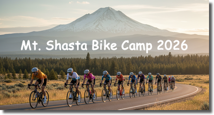
When: August 31st to September 4th Where: Mt. Shasta City, CA Cost: $25 per person (covers Happy Hour treats and any other bike camp expenses the club may incur)
What to Expect: Spectacular Routes: We will host two rides each day, a short route and a long route. Club Vibes: Share the road and the laughs with fellow club members. Whether you’re smashing out climbs or soaking up the miles, it’s all about enjoying the ride with your club members. Happy Hour: After the rides, enjoy happy hour snacks and drinks, plus group dinners, storytelling, and plenty of chances to relive the day’s highlights.
The SFCC does more than just ride around the foothills...we work to improve the riding safety and convenience for all riders in the area. Members of our club have formed a safety and advocacy team working with Placer County to improve the cycling infrastructure and ensure future development includes bicycle friendly features. Read more about our team's current projects and accomplishments and if you are interested in sharing your vision for a fun and safe cycling community.